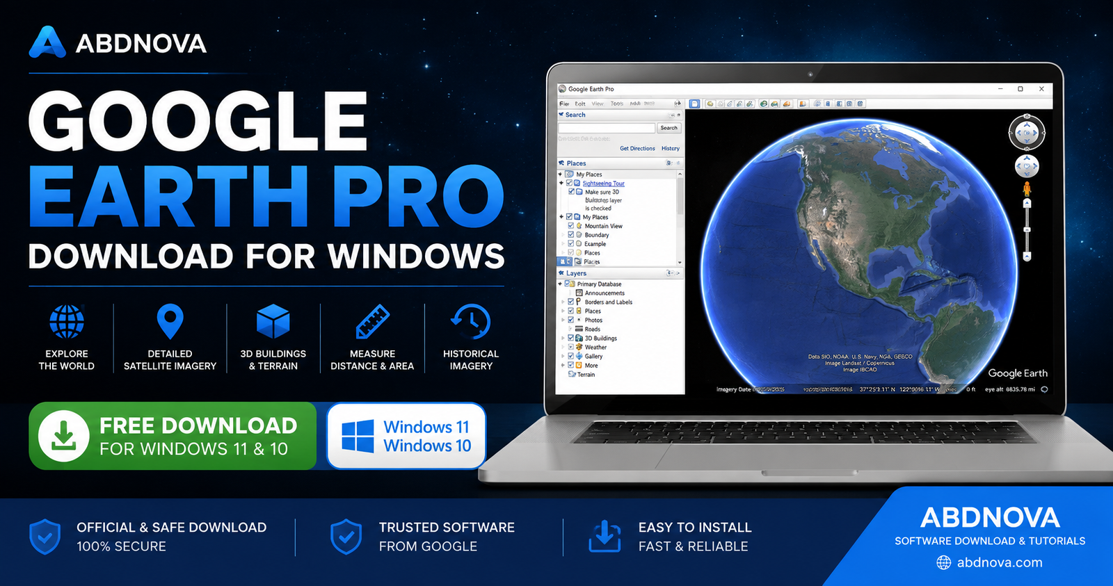

Google Earth Pro Download for Windows – Satellite Maps & 3D Exploration
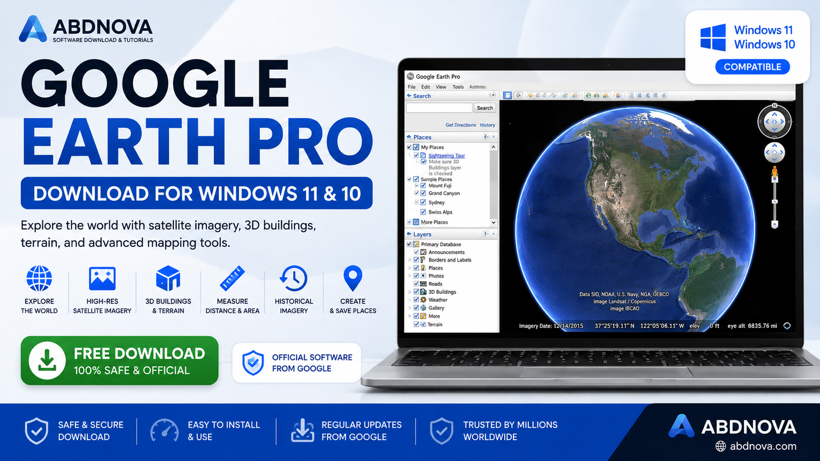
Download Google Earth Pro for Windows 11 and 10 to explore satellite imagery, 3D buildings, historical maps, terrain, measurement tools, and geographic data.
Google Earth Pro is a free desktop application from Google that lets you explore the world using satellite imagery, aerial photography, 3D terrain, buildings, maps, and geographic information.
It also includes advanced desktop tools for viewing historical imagery, measuring distance and area, creating placemarks, drawing paths and polygons, opening KML/KMZ files, and saving map images.
In this guide, you will learn how to download Google Earth Pro safely, install it on Windows 11 or Windows 10, explore its main features, use historical imagery and measurement tools, work with KML/KMZ files, and troubleshoot common problems.
Google Earth Pro Download – Quick Overview
| Information | Details |
|---|---|
| Software | Google Earth Pro |
| Developer | |
| Category | Maps & Geography |
| Platform | Windows |
| Supported Windows | Windows 11 & Windows 10 |
| License | Free |
| Satellite Imagery | Yes |
| 3D Buildings & Terrain | Yes |
| Historical Imagery | Yes, where available |
| Distance & Area Measurement | Yes |
| KML / KMZ Support | Yes |
| Internet Connection | Required for most map content |
| Recommended Source | Official Google Earth Website |
What Is Google Earth Pro?
Google Earth Pro is the desktop edition of Google Earth. It combines satellite imagery, aerial photography, geographic information, 3D terrain, buildings, and map data inside an interactive globe.
You can zoom from a global view down to individual cities, roads, landmarks, buildings, and landscapes. Depending on the location and available data, Google Earth Pro can also display detailed 3D terrain and buildings.
Google Earth Pro is useful for:
- Exploring countries, cities, and landmarks.
- Viewing satellite and aerial imagery.
- Checking historical imagery.
- Measuring distances and areas.
- Creating placemarks, paths, and polygons.
- Exploring 3D buildings and terrain.
- Opening KML and KMZ files.
- Working with geographic information.
- Saving map images for projects and presentations.
Although the name still includes “Pro,” Google Earth Pro is available free of charge.
Google Earth Pro Desktop Interface
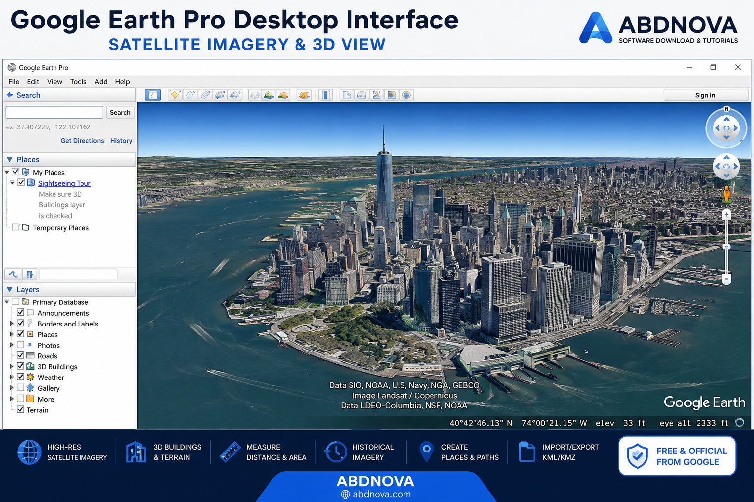
The Google Earth Pro desktop interface includes the globe view along with search, navigation, places, layers, measurement tools, historical imagery controls, and other geographic features.
Search
You can search for countries, cities, addresses, landmarks, or geographic coordinates and quickly navigate to the selected location.
Places
The Places section allows you to save and organize placemarks, paths, folders, and other geographic items.
Layers
Google Earth Pro provides multiple layers containing additional geographic information. You can turn individual layers on or off depending on what you want displayed.
Navigation Controls
You can zoom, rotate, tilt, and move around the map using your mouse, keyboard, or the built-in navigation controls.
Google Earth Pro Key Features
Satellite and Aerial Imagery
Google Earth Pro provides access to satellite and aerial imagery from many locations around the world. Image quality, resolution, and capture dates vary depending on the location.
3D Buildings and Terrain
Many supported locations can be explored in three dimensions. Mountains, terrain, buildings, and city environments can provide a more realistic view than a traditional flat map.
Historical Imagery
Historical imagery lets you view older satellite and aerial images where historical coverage is available. This can help you study how an area has changed over time.
Measurement Tools
Google Earth Pro includes tools for measuring lines, paths, polygons, distances, and areas using different measurement units.
Placemarks, Paths and Polygons
You can save important locations using placemarks, draw routes with paths, and highlight geographic areas with polygons.
KML and KMZ Support
Google Earth Pro supports KML and KMZ files, making it useful for viewing and sharing geographic projects and location data.
Save Map Images
Google Earth Pro provides tools for saving map views as images. Google imagery and map content remain subject to Google’s attribution and usage requirements.
Google Earth Pro Historical Imagery
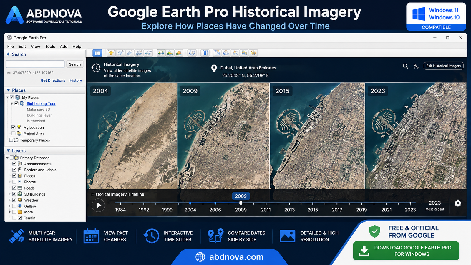
Historical imagery is one of the most useful features of Google Earth Pro. When older imagery is available, you can move through different dates and compare how the same location has changed.
Historical imagery can help you examine:
- Urban development.
- Construction projects.
- Land-use changes.
- Coastline changes.
- Roads and infrastructure.
- Environmental changes.
How to View Historical Imagery
- Open Google Earth Pro.
- Navigate to your desired location.
- Select the historical imagery option from the toolbar or menu.
- A timeline will appear when historical imagery is available.
- Move through the available dates.
- Compare imagery from different periods.
Not every location has the same historical coverage, and some places may have only a limited number of available dates.
Measure Distance and Area in Google Earth Pro
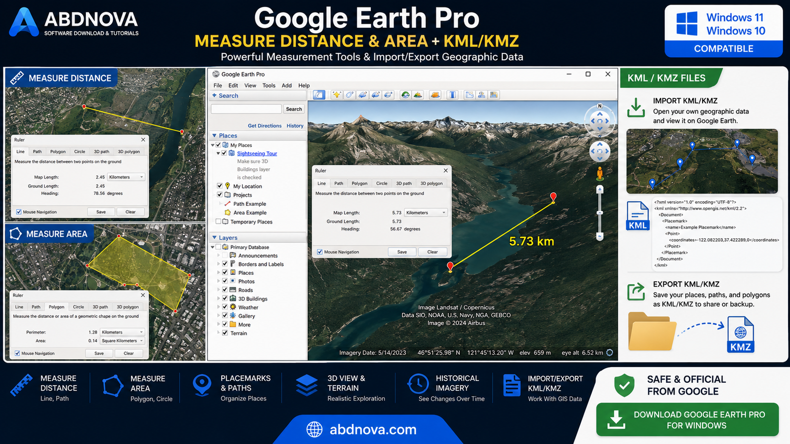
Google Earth Pro includes a Ruler tool that can be used to measure distances and areas on the map.
How to Measure Distance
- Open Google Earth Pro.
- Navigate to the required area.
- Open the Ruler tool.
- Select the appropriate measurement mode.
- Click the starting location.
- Add the next point or additional points.
- Select your preferred measurement unit.
How to Measure Area
For area measurements, use an appropriate polygon or area measurement mode and place points around the boundary you want to measure.
KML and KMZ Files
What Is KML?
KML stands for Keyhole Markup Language. A KML file can contain placemarks, paths, geographic coordinates, and other map-related information.
What Is KMZ?
KMZ is a compressed package used for KML-based content and associated resources.
Google Earth Pro can open compatible KML and KMZ files, making it convenient to view, organize, share, or back up geographic projects.
Google Earth Pro vs Google Earth Web
| Feature | Google Earth Pro | Google Earth Web |
|---|---|---|
| Desktop Application | Yes | No |
| Satellite Imagery | Yes | Yes |
| 3D Exploration | Yes | Yes |
| Historical Imagery | Yes | Features may differ |
| Advanced Measurement Tools | Yes | More limited / different |
| Geographic Data Tools | Yes | More limited |
| KML / KMZ Support | Yes | More limited / different workflow |
| Installation Required | Yes | No |
If you only want to quickly explore a location, Google Earth in your browser may be enough. Google Earth Pro is better suited to users who want a traditional desktop application and its additional mapping tools.
How to Download Google Earth Pro for Windows
The safest choice is Google’s official Google Earth website. Avoid unofficial mirrors, modified installers, cracked packages, or websites claiming to provide special unlocked versions.
- Visit the official Google Earth website.
- Find Google Earth Pro on desktop.
- Select the option to download Earth Pro.
- Review Google’s terms if they are displayed.
- Download the Windows installer.
- Wait until the installer finishes downloading.
- Google Earth Pro Crack
- Google Earth Pro Activated
- Google Earth Pro Keygen
- Google Earth Pro Modified
- Google Earth Pro Unlocked
- Unofficial repacked installers
How to Install Google Earth Pro on Windows
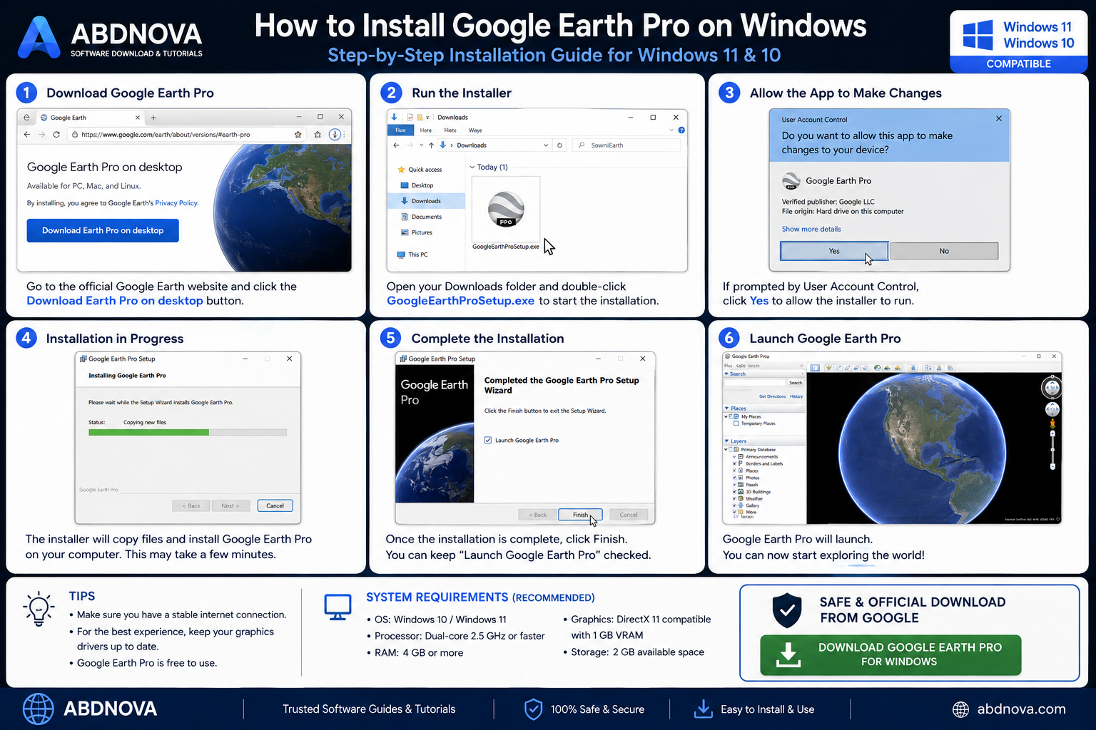
- Open the installer: Go to your Downloads folder and open the official Google Earth Pro setup file.
- Review the UAC prompt: If Windows asks for permission, verify the publisher information and continue.
- Allow installation: Let the installer download or copy the required application files.
- Complete setup: Wait until installation is finished.
- Launch Google Earth Pro: Open the application from the Start menu or desktop shortcut.
The exact installer screens may change as Google updates the software.
Getting Started With Google Earth Pro
Search for a Place
Use the search function to enter a country, city, address, landmark, or geographic coordinates.
Zoom and Navigate
Use your mouse wheel or navigation controls to zoom in and out. Drag the map to move between locations and use the camera controls to change your viewing angle.
Enable or Disable Layers
You can turn individual map layers on or off depending on the information you want displayed. Keeping unnecessary layers disabled can also make the map easier to read.
Google Earth Pro System Requirements
Google Earth Pro is designed to run on supported Windows computers, but performance depends on the complexity of the location, imagery, 3D content, graphics hardware, available memory, and internet connection.
- A currently supported Windows installation.
- Sufficient RAM for Windows and Google Earth Pro.
- A compatible graphics processor.
- Updated graphics drivers.
- Adequate free storage.
- A stable broadband internet connection.
Google may change official requirements over time, so check Google’s current documentation when hardware compatibility is important.
Does Google Earth Pro Work on Windows 11?
Yes. Google Earth Pro can be used on modern Windows PCs, including Windows 11. If the program does not work correctly after installation, first update Windows, Google Earth Pro, and your graphics drivers.
Is Google Earth Pro Free?
Yes. Google Earth Pro is free to use. You do not need to purchase the old commercial Pro license to install the current desktop application.
Does Google Earth Pro Work Offline?
Google Earth Pro is primarily designed to retrieve geographic imagery and information through an internet connection.
Some previously viewed content may remain cached locally, but Google Earth Pro should not be considered a fully offline worldwide mapping application.
Google Earth Pro vs Google Maps
Google Maps and Google Earth Pro serve different purposes.
Google Maps is generally better for:
- Navigation and directions.
- Traffic information.
- Businesses and places.
- Route planning.
- Everyday mapping.
Google Earth Pro is generally better for:
- Satellite imagery exploration.
- Historical imagery.
- 3D terrain and buildings.
- Distance and area measurements.
- KML and KMZ projects.
- Geographic visualization.
Is Google Earth Pro Safe?
Google Earth Pro is legitimate Google software. The main download-related risk comes from obtaining installers from unofficial sources.
- Download Google Earth Pro directly from Google.
- Avoid cracked or modified installers.
- Keep Windows updated.
- Keep Google Earth Pro updated.
- Do not disable Windows security simply to install an unknown package.
ABDNOVA does not provide cracked or modified versions of Google Earth Pro.
Google Earth Pro Troubleshooting
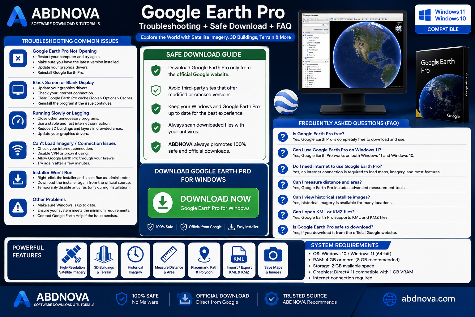
Google Earth Pro Won’t Open
Restart Windows, make sure you have the latest Google Earth Pro version, update your graphics driver, and reinstall the application if necessary.
Google Earth Pro Shows a Black or Blank Screen
Check your internet connection, update your graphics driver, restart Google Earth Pro, and use Google’s repair or troubleshooting options where available.
Google Earth Pro Is Running Slowly
Close unnecessary programs, update your GPU driver, use a stable internet connection, reduce unnecessary layers, and avoid loading too much complex geographic data at the same time.
Google Earth Pro Cannot Load Imagery
Check your internet connection, verify firewall or proxy settings if applicable, restart the program, and try the location again after a few minutes.
Google Earth Pro Installer Won’t Run
Download a fresh installer from Google’s official website, restart Windows, check pending Windows updates, and confirm that security software is not blocking the legitimate installer.
Frequently Asked Questions
Is Google Earth Pro still available?
Yes. Google continues to provide Google Earth Pro for desktop.
Is Google Earth Pro free?
Yes. Google Earth Pro is available free of charge.
Can I use Google Earth Pro on Windows 11?
Yes. Google Earth Pro can be installed on compatible Windows 11 computers.
Does Google Earth Pro work on Windows 10?
Yes. Google Earth Pro can be used on supported Windows 10 systems.
Can Google Earth Pro show old satellite images?
Yes. Historical imagery allows you to view older imagery where Google has historical coverage available.
Can Google Earth Pro measure distance and area?
Yes. Google Earth Pro includes tools for measuring distances, paths, polygons, and areas.
Can I open KML and KMZ files in Google Earth Pro?
Yes. Google Earth Pro supports KML and KMZ files.
Does Google Earth Pro require an internet connection?
An internet connection is normally required to load new imagery, geographic information, and most online content.
Is Google Earth Pro the same as Google Maps?
No. Google Maps focuses more on navigation and everyday mapping, while Google Earth Pro focuses on geographic exploration, satellite imagery, 3D views, historical imagery, measurements, and geographic projects.
Is Google Earth Pro safe to download?
Yes, when downloaded from Google’s official website.
More Google Software for Windows
If you use other Google services on your PC, you may also want to read our Google Drive for Desktop download guide to learn how to install and use Google’s desktop file synchronization software on Windows.
Final Thoughts
Google Earth Pro is a powerful Windows desktop application for exploring satellite imagery, 3D terrain, buildings, historical imagery, geographic information, and measurement tools.
It is especially useful for users who want advanced desktop mapping features such as historical imagery, KML/KMZ support, placemarks, paths, polygons, and distance or area measurements.
Most importantly, always download Google Earth Pro from Google’s official website and avoid unofficial, cracked, modified, or repackaged installers.
Ready to download Google Earth Pro?
Get the latest supported Windows desktop installer from the official Google Earth website. ABDNOVA recommends official sources only.